
1
of
2
Loading...
Paradise Cay Publications | SKU:
FMC007
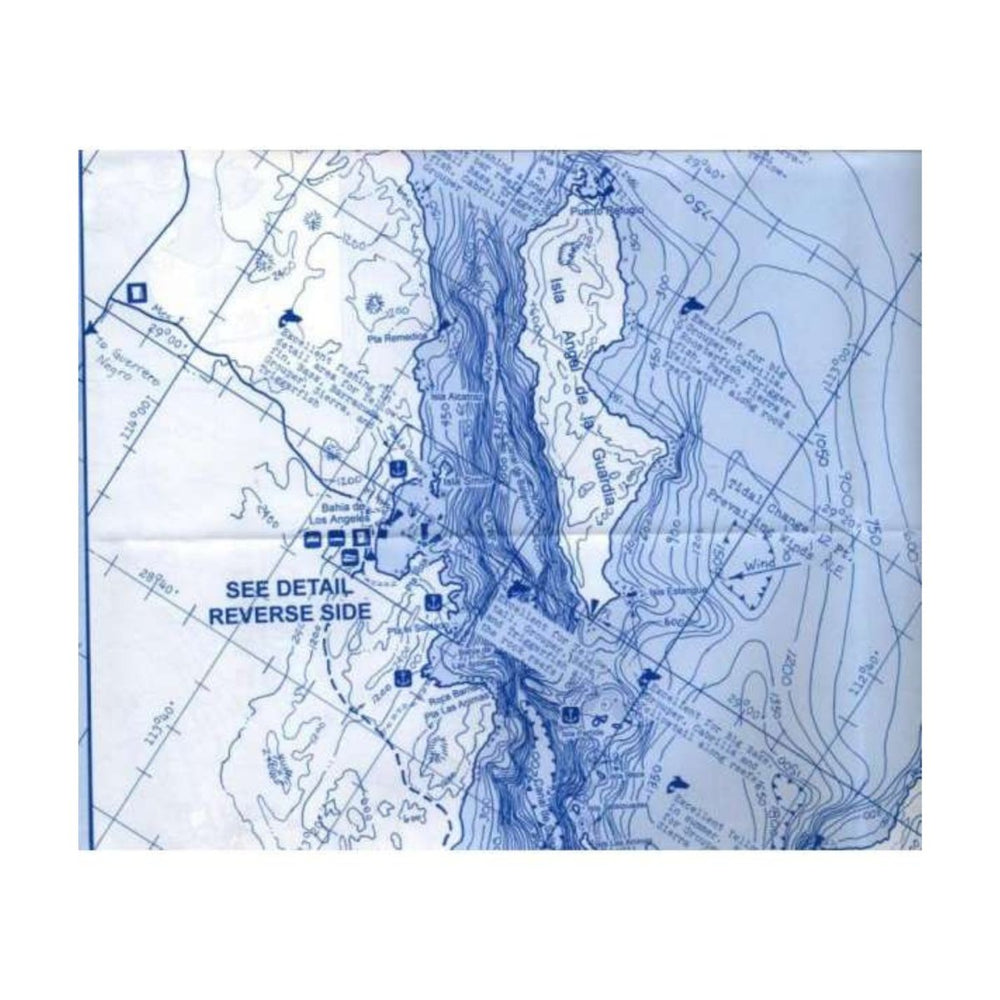
Fish-n-Map: Sea of Cortez North, San Felipe to Mulege
Regular price
$19.95
Unit price
/
Unavailable
Fish-n-Map: Sea of Cortez North, San Felipe to Mulege is backordered and will ship as soon as it is back in stock.
Couldn't load pickup availability
Description
Description
Printed on a waterproof, tear-resistant plastic
Folds to 3" x 4", Unfolds to 3' x 2'
Folds to 3" x 4", Unfolds to 3' x 2'
FEATURES:
- 30 Foot Underwater Depth Contours for Easy Structure Identification
- Fishing Locations
- Rocky Reefs Identified
- Longitude and Latitude Grids
- Onshore Facilities Identified including Boat Ramps, Piers, Jetties and Shore Fishing Access Areas
DETAILED AREAS:
- Bahia de Los Angeles, Scale 1:43,480
- Las Islas Encantadas, Scale 1:232,500
- Bahia San Francisquito
- Puerto Refugio
- Guaymas, Scale 1:55,555
MADE IN THE U.S.A.
Specifications
Specifications
| FMC007 | Specifications |
|---|---|
| FORMAT | Folding Waterproof Map |
| DIMENSIONS (IN) | 9 x 4.2 Folded |
| ISBN | 761428071231 |
| SUPPLIER/PUBLISHER | Fish 'n' Maps |
WARNING:
This product MAY expose you to chemicals, which are known to the State of California to cause cancer, birth defects and/or other reproductive harm. For more information go to
www.P65Warnings.ca.gov
.


